The 10 Best High Altitude Hikes in the U.S.
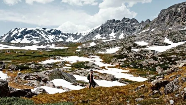
High altitude hiking is a rewarding experience. You have a chance to get above the treeline and see extensive valley views. Plus, the good news is that even if you aren’t an expert mountaineer, you can still hike to the top of some amazing high altitude peaks.
The top 10 high altitude hikes that we picked range from beginner-friendly to intermediate. I purposefully did not include any hikes that require expert level experience. Some of the hikes will be more difficult than others, but their main focus is on hiking to the top of a mountain, not climbing.
For a baseline, high altitude hiking is generally anything 8,000 feet or above. If you want more detailed information about high altitude hiking, check out our post What is Considered High Altitude Hiking?
Our 10 favorite high altitude hikes in the U.S.
These mountains are organized alphabetically by state, not by overall rating. Along with elevation, we have included a solitude scale. This will give you an idea of how busy to expect the trails to be. A one on the solitude scale equals heavy traffic, and as you climb higher on the scale, the more solitude there will be.
1. Mount Whitney, CA
Elevation: 14,505 feet (4,421 m)
Round Trip Mileage: 22.5 miles
Solitude rating: 1 / 5
Mount Whitney is the highest point in the contiguous United States. Located near Lone Pine, California, this out and back trail is another heavily trafficked high altitude hike. The best time of year to hit the Mount Whitney Trail is April – October.
While some hikers choose to hike the mountain out and back in one day, there are two designated campgrounds to stop at on route. To complete in one day, you’ll have to commit to an early start (around 2-4 am).
From May – October, the trail is permit only. You can apply for a permit at the Lone Pine Ranger station to enter the daily lottery. You can also apply for a permit online . Requests generally exceed the available number of permits, so apply early if you want to hike.
Although the hike may be somewhat crowded and physically demanding, it is well worth it. It is recommended you spend some time acclimating before this hike as well.
- A true hiking milestone
- Dogs allowed on the trail up to Trail Crest campground
- Camping on route
- Permits limit the number of hikers
- Permits are difficult to get (lottery only)
- Tends to be crowded
- 97 switchbacks
2. Humphrey’s Peak, AZ

Elevation: 12,633 feet (3,851 m)
Round Trip Mileage: 10.5 miles
Solitude rating: 1 / 5
Arizona’s tallest peak is a heavily-trafficked trail 11 miles outside of Flagstaff, AZ. The proximity to Flagstaff and Phoenix is part of the reason weekends on this trail tend to be jam-packed. However, the hike itself is not forgiving.
Fun Fact: It is actually an extinct volcano from the San Francisco Mountain Range.
On the trail, you can expect a consistent number of switchbacks as you make your way through the Coconino National Forest . Once above about 11,500 feet, you’ll be above a treeline of ponderosa pines. The remainder of the hike will tease you with a few false summits as you make your way to the top.
Pros
- Accessible from Phoenix and Flagstaff
- Great weekend trip idea
- Well-maintained trails
- View of Grand Canyon from the summit on a clear day
- Open year-round
- Crowded, especially on weekends
- Lack of signage on the trail
- A lot of loose rock above the treeline
3. Mount Shasta, CA (via Avalanche Gulch)
Elevation: 14,179 feet (4,322 m)
Round Trip Mileage: 10.3 miles
Solitude rating: 3 / 5
Although this mountain made the list, it is only recommended for hikers that have experience in the mountains. It doesn’t require any expert-level skills beyond navigational ability. Still, there are no specific trails leading to the summit. Most backpackers follow one of the short approach trails to Avalanch Gulch or Clear Creek to ascend.
Then, the rest of the hike is done on cross-country routes in undeveloped and unmarked terrain.
While this mountain is a non-technical climb, there are still dangers such as rockfall as well as long, strenuous scree fields. There are several challenging steep sections, so be well prepared when embarking on this hike.
Mt. Shasta Wilderness area does require permits to enter. However, they are free, and there is no current quota. Rangers highly recommend hiking Mt. Shasta as a two-day trip to get used to the altitude.
Pros
- Not very crowded
- No limit on permits
- Backcountry camping experience
- Spring wildflowers
- Out and back trail
- The summit will feel well earned
- Unmarked trails
- Multiple routes, easy to get lost
- Strenuous scree fields to climb
- Limited backpacking season
4. Mount Bierstadt, CO

Elevation: 14,065 feet (4,287 m)
Round Trip Mileage: 6.8 miles
Solitude rating: 1 / 5
Considered another one of Colorado’s “easier” 14ers, Mount Bierstadt is also heavily trafficked, especially on weekends. It is located near Silver Plume, Colorado, and is within an hour and a half drive from Denver.
The trail leading to the summit is almost entirely in the Mount Evans Wilderness area. The accessibility of the peak and distance from major cities makes it one of the most crowded mountain trails. Getting an early start is recommended, but you can ensure that you will not be alone on this trail.
- Accessible for beginners
- A short drive from Denver
- Fun rock scrambling near the summit
- View of an alpine lake
- Can be done in one day
- Can be extremely crowded
- Early start necessary to avoid afternoon storms
5. Grays/Torreys Peak, CO
Elevation: 14,270 feet (4,349 m)
Round Trip Mileage: 7.9 miles
Solitude rating: 1 / 5
There is no such thing as an “easy” 14er, but there are ones that are doable in a day and much more welcoming to beginner high elevation hikers. The best part of this hike is that you can bag two peaks in one. Grays and Torrey’s peak is near Idaho Springs, CO, and is heavily trafficked. You can guarantee that it will be packed on weekends.
Grays Peak is the highest point on the continental divide, and you summit this first. Then, you traverse the saddle between the peaks for less than a mile to summit Torrey’s Peak.
- Summit two peaks in one hike
- Great for an intro to 14ers
- Dogs allowed on leash
- Close enough to Denver for a weekend trip
- 4×4 vehicle required to get to trail and camping
- Crowded trails
6. Mount Mitchell, NC

Elevation: 6,683 feet (2,037 m)
Round Trip Mileage: 11.3 miles
Solitude rating: 1 / 5
Despite the fact that Mount Mitchell doesn’t fit into the parameters of “high altitude” because it is below 8,000 feet, it had to be on the list. It is the highest peak in the Appalachian mountain range and can be a great starting point for hikers starting to tackle high elevation peaks.
Located outside of Burnsville, NC, the Mount Mitchell Trail is considered to be heavily trafficked. Although this out and back trail is busy, it is a difficult climb. The trail starts in the Black Mountain Campground, making it a great day hike for people staying there.
From the summit, you will have a view of Grandfather and Table Rock in the distance. To return, you can go back the way you came or add an extra 3-mile (round trip) hike to Mount Craig via Deep Gap Trail. Mount Craig is the 2nd highest point in the Eastern U.S.
There is also a paved trail to drive to the top of the mountain. So, the summit may be more crowded than the trail leading up to it.
- Accessible from Burnsville and Ashville, NC
- Can be done in a day
- Amazing views
- The tallest peak in the Appalachian range
- Well-maintained trail
- Tends to be busy
- Not over 8,000 feet
7. Wheeler Peak, NV
Elevation: 13,064 feet (3,982 m)
Round Trip Mileage: 8.6 miles
Solitude rating: 3 / 5
The Wheeler Peak Summit Trail is located in Great Basin National Park. It is moderately trafficked and accessible via the paved Wheeler Peak Summit Drive. The trailhead starts above 10,000 feet, so many hikers take a day to acclimate to the elevation.
It is recommended that you hike this trail June-September for ideal conditions. As it is a desert landscape, flora and fauna will be unique. Once above the treeline, this peak is notoriously windy, so a wind breaking jacket is a must.
- Not a super busy summit trail
- 3,000-year-old bristlecone pines
- Hike through diverse landscapes
- Overlook Great Basin
- Limited summit period each year
- Steep with intense elevation gain in a short period
8. Mount Scott, OR

Elevation: 8,934 feet (2,723 m)
Round Trip Mileage: 4.5 miles
Solitude rating: 2 / 5
Mount Hood may be the most famous peak in Oregon, but it is still considered a technical mountaineering route. So, for a hike up summit, we chose Mount Scott. This is a moderately trafficked out and back trail with unforgettable views of Crater Lake.
Mount Scott is the highest point in Crater Lake National Park . It has a pretty short summit season, though. The park is sometimes not clear of snow until mid-July and has seen snow as early as October. As it is located in a National Park, there are entry fees.
- Best views of Crater Lake
- A short hike that can be done in a day
- Well-maintained trail
- Not overly crowded
- Short summit season
- Park fees
9. Guadalupe Peak, TX
Elevation: 8,749 feet (2,667 m)
Round Trip Mileage: 8.1 miles
Solitude rating: 1 / 5
A hike to the tallest point in all of Texas is accessible year-round. Guadalupe Peak is a heavily trafficked trail, but it is a difficult one as well. It can be done in a day and takes the average hiker 6-8 hours to complete. The first mile and a half is actually the steepest section, so once you make it past that, you will be relieved.
As this peak is situated in the Chihuahuan desert, there is minimal shade on the trail. The peak is located in the Guadalupe Mountains National Park . Atop the mountain, you will have a stunning view of the park’s claim to fame: El Capitan.
- Can be hiked in one day
- Diverse landscape and ecosystems
- Year-round access
- Panoramic views of the National Park
- Usually crowded
- Limited shade
- Park fees
10. Avalanche Peak, WY
Elevation: 10,568 feet (3,221 m)
Round Trip Mileage: 4.7 miles
Solitude rating: 3 / 5
This out and back trail is located near Yellowstone National Park. One of the main features of this hike is an alpine lake. There will be some other hikers on the trail, but it is only considered moderately trafficked, so some areas of solitude will exist. It is also a strenuous hike despite the short mileage.
Past the treeline, the peak is quite windy and usually cold. The view of Yellowstone is well worth the bit of hiking in the wind. Much of the hike, you will enjoy forests with meadows filled with wildflowers. The peak has a relatively short hiking season as there is still often snow through mid-July. Pack your layers because, on the barren summit, it may be windy, cold, and rainy.
- More secluded trail
- Can be hiked in one day
- Breathtaking views of the National Park
- No fee or permit required
- Limited hiking season
- Cold and windy
A note on Colorado 14ers and Alaska’s peaks:
There are so many incredible peaks in Colorado. While there are amazing peaks throughout all of the United States, Colorado takes the cake with hikeable high altitude mountains.
Colorado has 59 named mountain peaks that exceed 14,000 feet, but only 53 official 14ers. Their high concentration of 14ers is more than any other state. There are 96 14ers in all of the United States. That means that over half of them are located in Colorado.
The great thing about Colorado’s 14ers is that the majority of them are hikeable. There are still a few that are quite technical and dangerous, though. While I’d love to go over all of Colorado’s peaks with you, that would need an article in itself. There are a couple in our list above, but there are plenty of others worth looking into!
Related articles:
Alaska is another mountain adventure area in itself. When putting together the list, it took a long time to decide whether or not to include Alaskan mountains here. I decided not to simply due to elevations, overall accessibility, and technical skills required. Alaska has a ton of adventure opportunities, and a crazy number of mountains all high altitude junkies should research.
…Happy ‘high altitude’ hiking!
There was only room for 10 high altitude hikes on this list, but there are so many more to choose from! The goal was to give you a good base for peaks to start with on your journey into high altitude hiking. I wanted the peaks and hikes to be accessible with little to no technical mountaineering knowledge required.
There is always a risk of altitude or mountain sickness when hiking above 8,000 feet. Be physically prepared when hiking in high elevations but also know the signs and symptoms of acute mountain sickness. A little extra awareness and caution will go a long way in the mountains.
Hopefully, a few of these peaks can be checked off your list soon. Enjoy the views on your peak-bagging journeys!
Up Next In Mountain Readiness:
From market farming to wilderness survival guide to forestry technician and climbing instructor, Meg has an eclectic work history. But there’s one common factor across all her pursuits: the outdoors. With a formal education in writing, Meg can translate her outdoor experiences into accessible and relatable content for any reader. Now pursuing freelance writing full-time, Meg has found a new base in Pheonix, AZ where she splits her time between writing and new desert adventures.
Posted on Last updated: March 13, 2020
Mount Rogers: Hike the Appalachian Trail to Virginia’s Highpoint in Mouth of Wilson
At an elevation of 5,730 feet, Mount Rogers is the highest point in Virginia. This sought-after peak can be reached by way of a 9.0-mile out-and-back hike.
You can reach Mount Rogers from Elk Garden or from Massie Gap, which is at Grayson Highlands State Park. Both routes follow the Appalachian Trail.
The Appalachian Trail lead hikers to the blue-blazed Mount Rogers Trail for the final 0.6 miles that guide hikers to the coveted highpoint in Virginia.
It’s worth noting, however, that there are no panoramic views. It’s an entirely forested summit, but at least it’s a fairly easy highpoint to check off the list.
| Trail Stats | |
|---|---|
| Length | 9.0 miles |
| Difficulty | Moderate |
| Trail Type | Out-and-Back |
| Elevation Gain | 1,785 feet |
| Duration | 4-5 hours |
| Terrain | Mostly dirt & rock trails |
| Dog-Friendly | Yes |
| Fee | Free |
| Driving Directions | Click Here |
Mount Rogers Hike
There are pros and cons to both routes to the state’s tallest peak. The northbound route is shaded and begins from a good-size free parking lot at Elk Garden.
The southbound route includes a trek across Wilburn Ridge, where wild ponies are plentiful. However, you’ll need to pay $7-$10 to park at Grayson Highlands.
The Wilburn Ridge route is also nearly full sun. It rarely gets very hot in this area, but this is worth taking into consideration since it’s a fairly long hike.
Elk Garden
I hiked to Mount Rogers from Elk Garden on State Route 600 (Whitetop Road). It’s easy to find and there is room for more than a dozen cars to park.
There is also a vault toilet on the right-hand corner when you drive in. Always a plus. However, there is no lock on the door. Definitely not a plus.
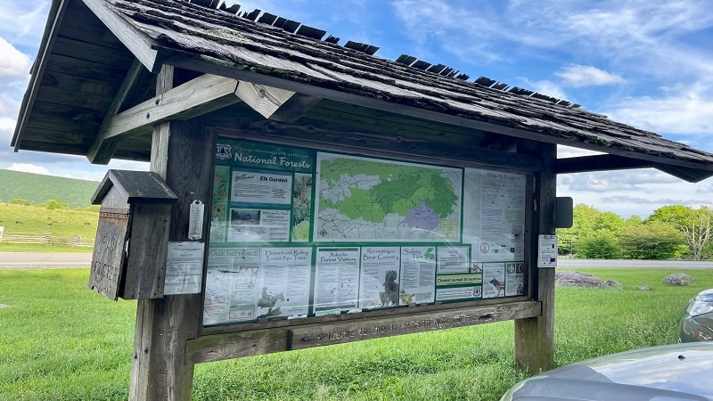
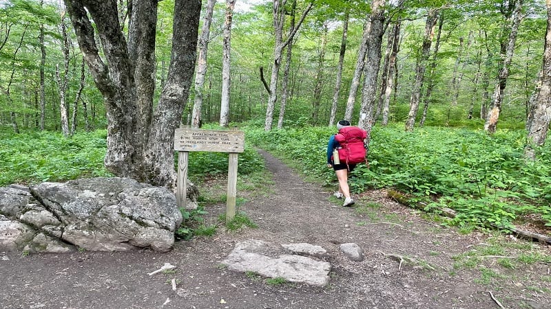
There is a large trail kiosk with a Mount Rogers trail map if you want to snap a photo before you set off on this hike, which begins across Whitetop Road.
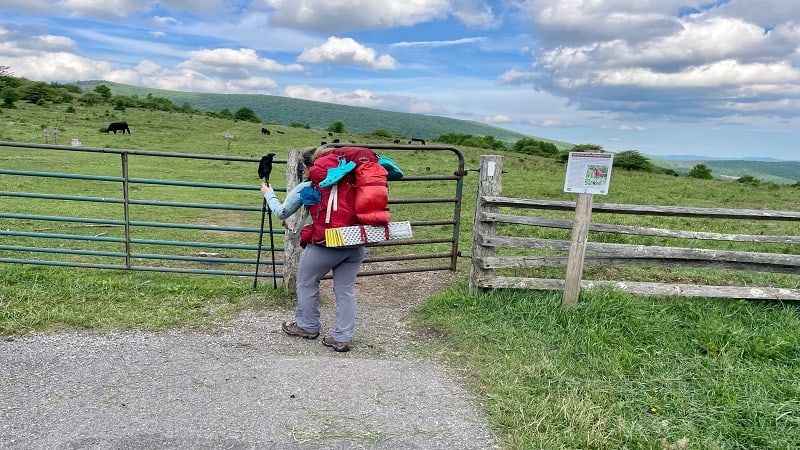
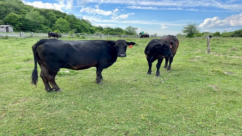
Open and close the gate that keeps in the cows (yes, you will see lots of cows), then continue along the Appalachian Trail. A trail sign nudges you to the left.
It’s a mild ascent across open grassland, but you’ll soon enter the shade of the forest at the 0.5-mile mark. Then a sign for Lewis Fork Wilderness.
So there is no confusion, you will be in the Jefferson National Forest, Lewis Fork Wilderness and Mount Rogers National Recreation Area all at the same time.
Appalachian Trail
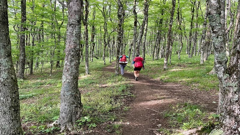
From here, it’s a lot of hardwood forest. It’s quiet and relaxing. The southbound route by way of Grayson Highlands is much more bustling with pony-seekers.
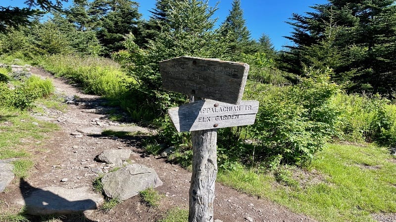
At the 2.0-mile mark, a sign lets you know you’re going in the right direction and that the summit of Mt. Rogers is just 2.5 miles ahead on the trail.
Here you can also turn right for a spur trail to water sources or to connect with the Virginia Highlands Horse Trail.
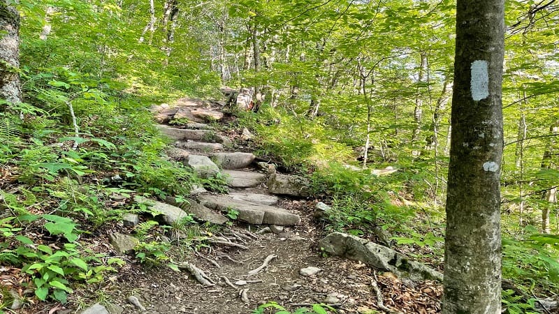
You’ll reach a switchback and a trail junction at the 2.1-mile mark. Make a hard right to continue following white blazes for the Appalachian Trail to Mount Rogers.
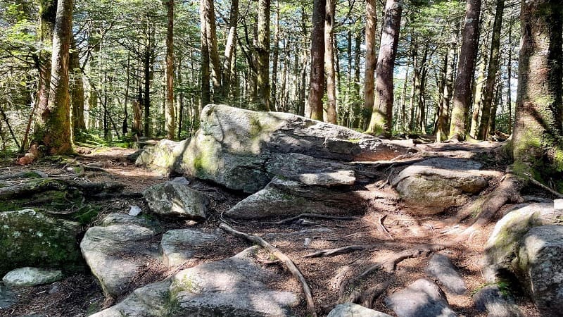
As you ascend, you’ll encounter a couple of sets of stone steps built into the trail to help manage the climb. At the 3.0-mile mark, get ready for a reward.
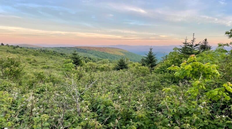
Just steps off the trail you’ll revel in wide-open views across the grassy highlands. It’s seriously so beautiful and a nice reward for getting to this point.
Take in the great views of lush meadows and open balds, then keeping moving through the forest. There’s a primitive camp site at the 3.3-mile mark.
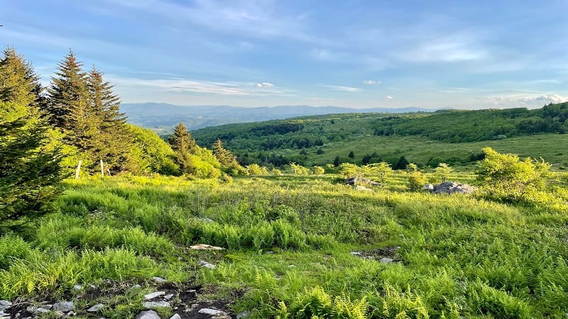
Once you get to the 3.7-mile mark, you’re out of the woods for the next 0.2-miles, so plan to savor views that extend for miles. Then, one more camp site.
Mount Rogers Trail
At the 3.9-mile mark, you’ll arrive at the blue-blazed Mount Rogers Trail. Turn left here. You’re back in the forest, but there are a few surprises.
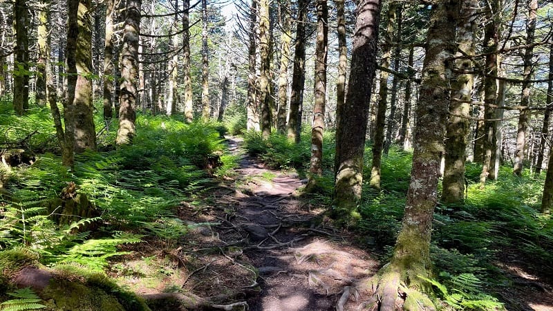
You’re still climbing and it seems like a typical walk in the woods, until it becomes very Jurassic Park-like. It’s very mossy, like a temperate rain forest.
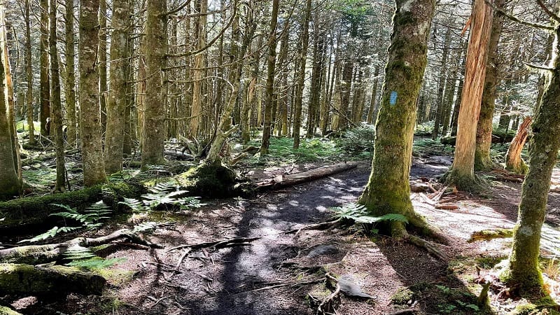
You have left the hardwood forest and entered a spruce-fir ecosystem. Notice the dense, dark evergreens that begin to populate the trail.
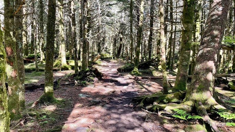
This spruce-fir growth increases as you ascend on the Mount Rogers Spur Trail. Moss covers fallen logs, while ferns carpet areas of the forest floor.
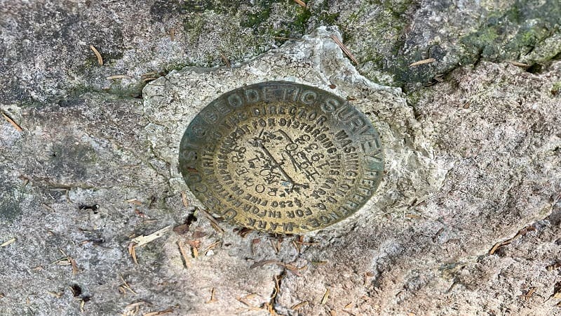
You will arrive at the Mount Rogers summit at the 4.5-mile mark. As I noted above, there is nothing to see. It is completely closed in.
A large boulder appears to mark the summit of Mount Rogers, as well as a survey marker to mark the precise point of highest elevation.
From here, simply re-trace your steps to the trailhead to complete your hike. However, I would suggest that you continue north for more views.
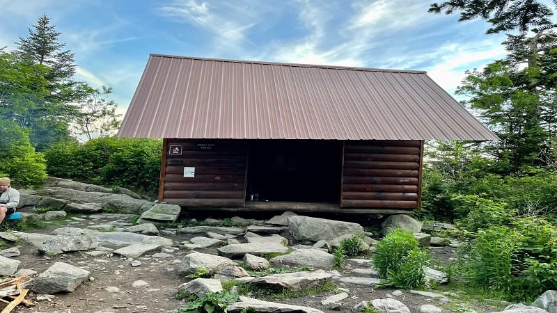
Thomas Knob Shelter
If you continue north on the Appalachian Trail in Southwest Virginia for less than 0.3 miles you will reach the Thomas Knob Shelter on the right.
Unlike most shelters, which can be reached by way of a short walk down a spur trail, this shelter is literally alongside the trail. You can’t miss this one.
You will also pass camp site after camp site. Backpacking and camping along this scenic ridge are very popular and nice campsites are plentiful.
If you did not bring a tent and sleeping bag, you will most certainly wish that you had. Or at least you will make a note that you will be back another day.
Wrap-Up Notes
From the Massie Gap parking lot, most day hikers take about 3 to 4 hours to complete this hike to the top of the tallest mountain in Virginia.
If you opt to visit Grayson Highlands State Park in Mouth of Wilson after Mount Rogers, say hello to (but do not feed or touch) the herds of wild ponies.
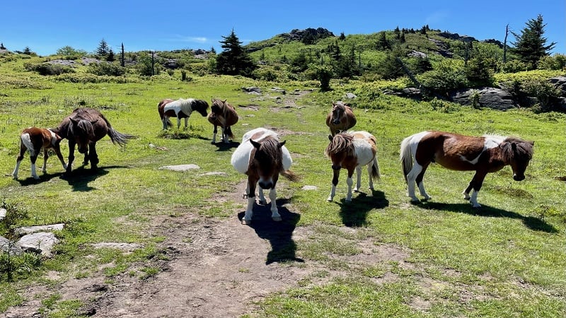
The Grayson Highlands ponies are not native, but were introduced to maintain the grassy balds and control the spread of thorny brush on this one-time farmland.
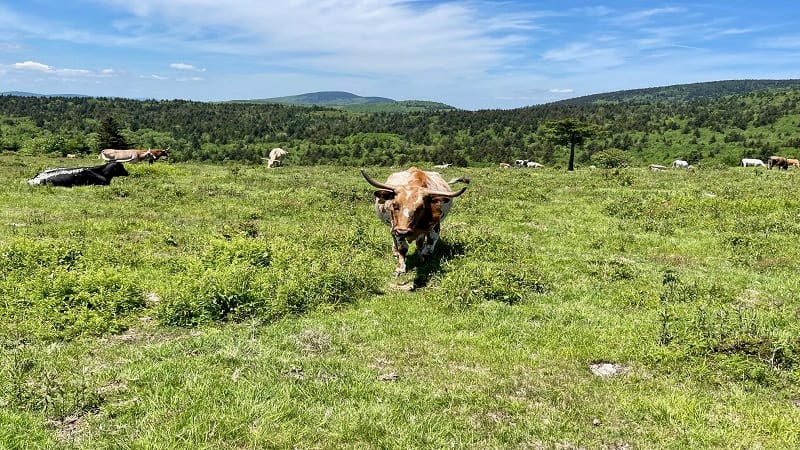
You may also see steer roaming about Grayson Highlands and the Mount Rogers NRA. They mostly mind their own business, eating grass.
Another great hike at Grayson Highlands is Twin Pinnacles, which allows you to savor spectacular views from Big Pinnacle and Little Pinnacle.
This hike begins across Grayson Highland Lane from the Massie Gap trailhead. There are more miles of trails too, like the Haw Flats Trail and Split Rock Trail.
Erin Gifford
Erin Gifford has completed more than 300 hikes in Virginia. She is also the author of three hiking guidebooks from Falcon Guides. Need help finding a hike? Check out the Trail Finder feature or send Erin an email at [email protected] .
- ← Dickey Knob Trail: A Summit Hike in the Raccoon Branch Wilderness Near Sugar Grove, Virginia
- Need to Know: Can Bears Climb Trees? →
https://trailandsummit.com/best-high-altitude-hikes-in-the-us/https://gohikevirginia.com/mount-rogers-hike/
